
News
Hurricane Isaias Update #4
Date:Saturday, October 10, 2026 at 9:00 a.m.
Rainy and breezy conditions will continue Saturday as Post-Tropical Cyclone Isaias tracks well west of Chatham County. Potential impacts include heavy rainfall, coastal flooding, and a slight risk of tornadoes. Coastal Chatham may also experience high surf and dangerous rip currents today.
Coastal Flood Advisory: A Coastal Flood Advisory is in effect this morning from 7 a.m. to 11 a.m. High tide at 8:45 a.m. could cause flooding in low-lying areas.
Flood Watch: A Flood Watch is in effect through 2 a.m. Sunday.
Know the Risks:
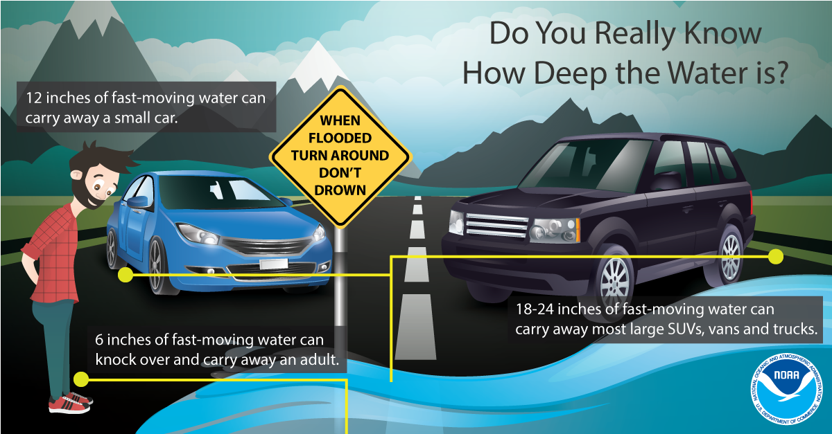
- Never drive through flooded roadways. Turn around, don’t drown. Just 6 inches of fast-moving water can knock an adult off their feet, while 12 inches can sweep away a small car.
- Avoid flooded low-lying areas during high tide.
- Stay out of dangerous surf and rip currents.
- Monitor official weather alerts and be prepared to act if conditions worsen.
Stay informed and be ready to take action. Text CEMA to 77295 or follow the Chatham Emergency Management Agency (CEMA) for updates.
Español:
Las condiciones de lluvia y viento continuarán durante el sábado, mientras el ciclón postropical Isaías se desplaza bastante al oeste del condado de Chatham. Los posibles impactos incluyen lluvias intensas, inundaciones costeras y un riesgo leve de tornados. Las zonas costeras del condado de Chatham también podrían experimentar oleaje fuerte y corrientes de resaca peligrosas durante el día de hoy.
Aviso de inundaciones costeras: Hay un aviso de inundaciones costeras vigente esta mañana, de 7:00 a. m. a 11:00 a. m. La marea alta, de las 8:45 a. m., podría causar inundaciones en las zonas bajas.
Vigilancia de inundaciones: Hay una vigilancia de inundaciones vigente hasta las 2:00 a. m. del domingo.
Conozca los riesgos:
-
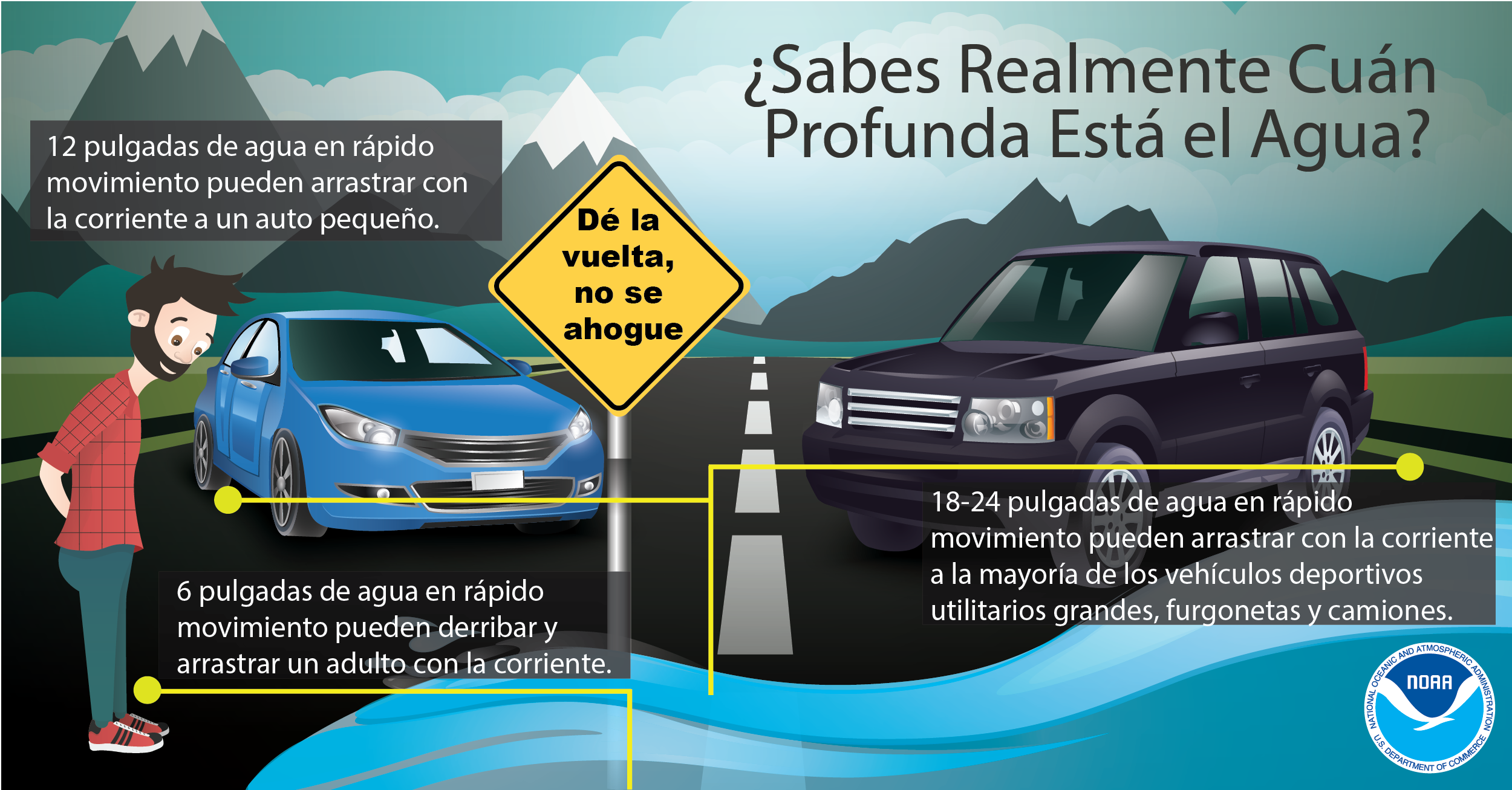
Nunca conduzca por calles o carreteras inundadas. ¡Dé la vuelta, no se ahogue! Tan solo 6 pulgadas (15 centímetros) de agua que corre rápidamente pueden hacer que una persona adulta pierda el equilibrio y caiga. Con 12 pulgadas (30 centímetros), el agua puede arrastrar un automóvil pequeño.
-
Evite las zonas bajas que puedan inundarse durante la marea alta.
-
Manténgase alejado del oleaje peligroso y de las corrientes de resaca.
-
Preste atención a las alertas meteorológicas oficiales y prepárese para actuar si las condiciones empeoran.
Manténgase informado y preparado para actuar. Envíe un mensaje de texto con la palabra CEMA al 77295 o siga a la Agencia de Manejo de Emergencias del Condado de Chatham (CEMA) para recibir actualizaciones.
This translation is made possible through a partnership with GROW Initiative GA/Esta traducción es posible gracias a una colaboración con GROW Initiative GA, una organización sin fines de lucro.
Hurricane Isaias Update #3
Date:Friday, October 9, 2026 at 7:00 p.m.
Chatham County is at a marginal risk of isolated tornadoes this evening into Saturday morning.
Hazards include localized wind damage from brief and fast-moving tornadoes and/or waterspouts.
According to the National Weather Service in Charleston, the greatest risk along the Georgia coast begins Saturday morning and could spread inland through the afternoon.
Bring loose items inside and ensure you have a way to receive alerts. Lastly, make sure you have a tornado-safe place in your home or workplace.
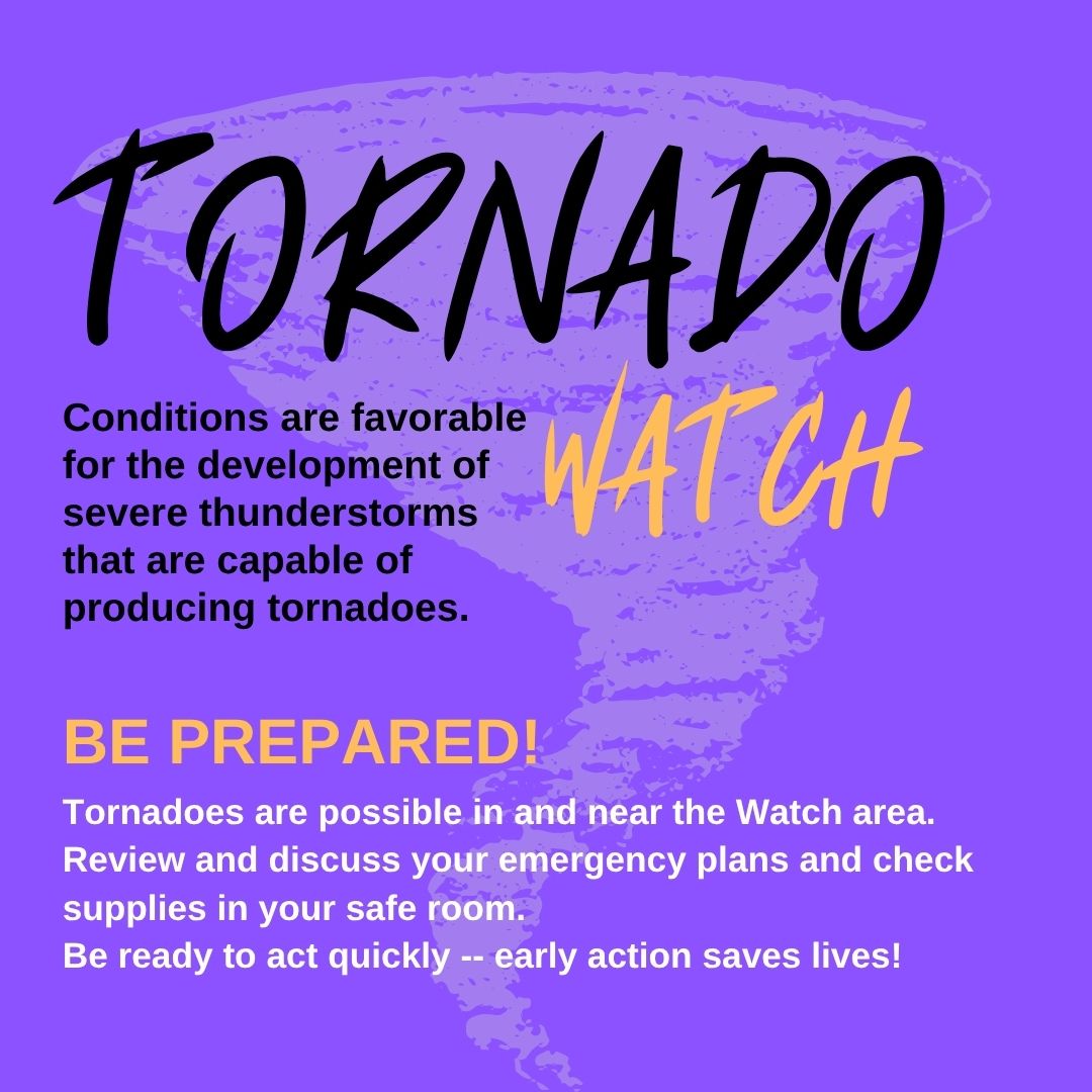
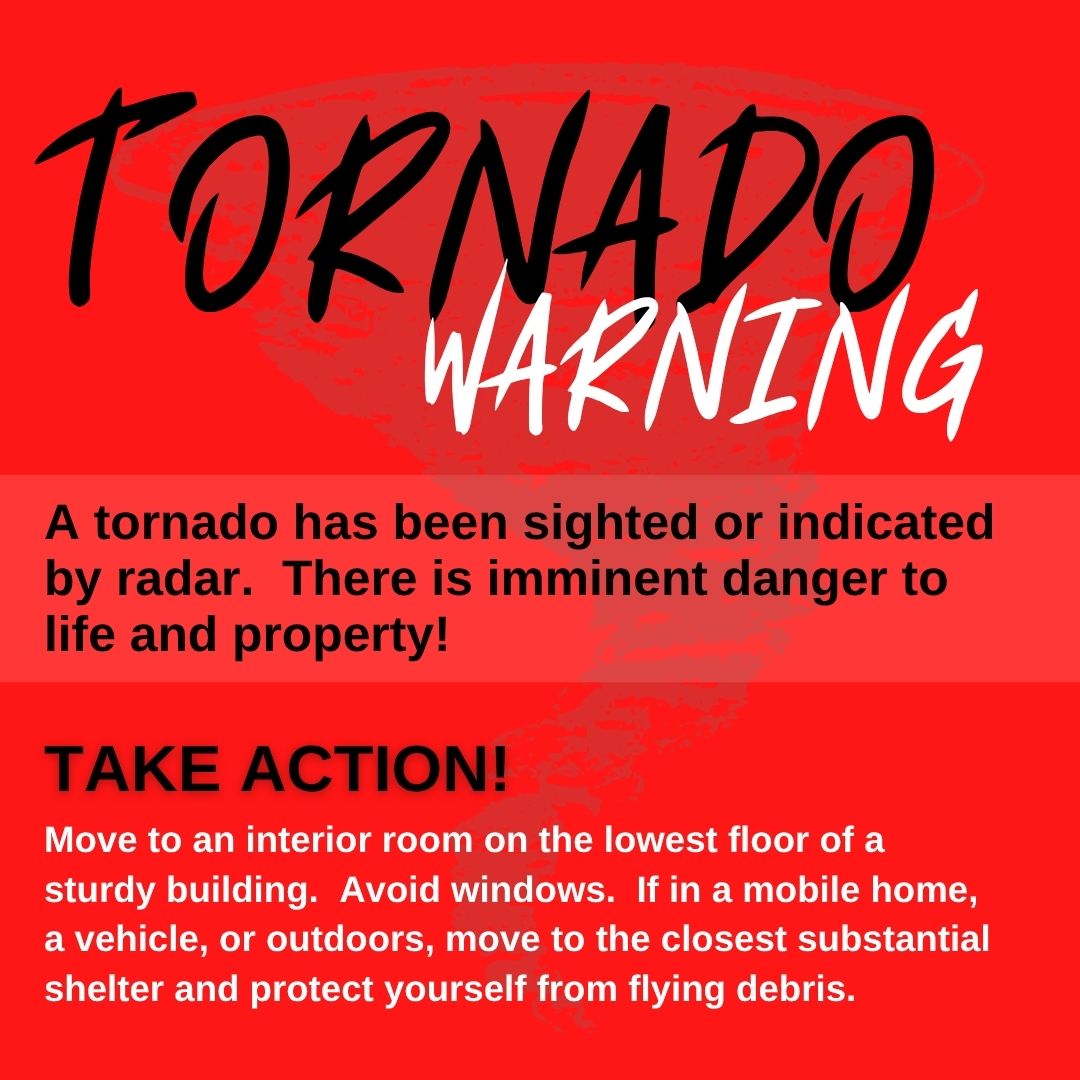
Tornado Watch vs Tornado Warning Know The Difference!
Tornado Watch: Tornadoes are possible. Stay alert and be prepared to take shelter.
Tornado Warning: A tornado is happening or expected soon. Seek safe shelter immediately.
Remember to follow official weather updates by texting CEMA to 77295 or by following CEMA on Facebook (Chatham Emergency Management Agency), Instagram (Chatham EMA), and X (Chatham EMA).
____________________________________
El condado de Chatham tiene un riesgo elevado de tornados aislados desde esta noche hasta la mañana del sábado.
Los peligros incluyen daños causados por vientos fuertes debido a tornados de corta duración que se desplazan rápidamente y/o trombas marinas.
Según el Servicio Meteorológico Nacional en Charleston, el mayor riesgo en la costa de Georgia comenzará el sábado por la mañana y podría extenderse hacia el interior durante la tarde.
Guarde dentro de su hogar los objetos que puedan ser arrastrados por el viento y asegúrese de tener una manera de recibir alertas de emergencia. Además, identifique un lugar seguro donde pueda refugiarse en caso de tornado, ya sea en su hogar o lugar de trabajo.
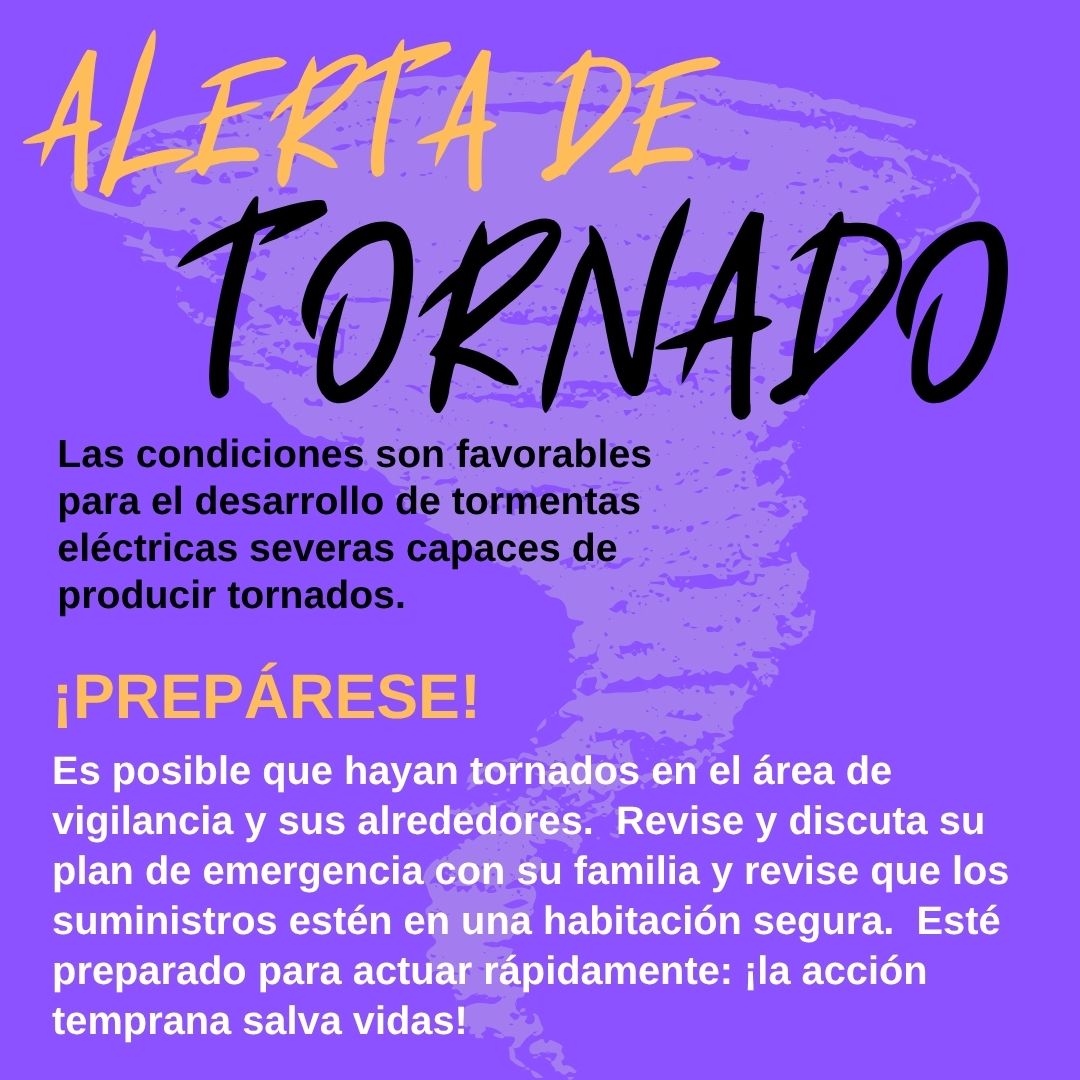
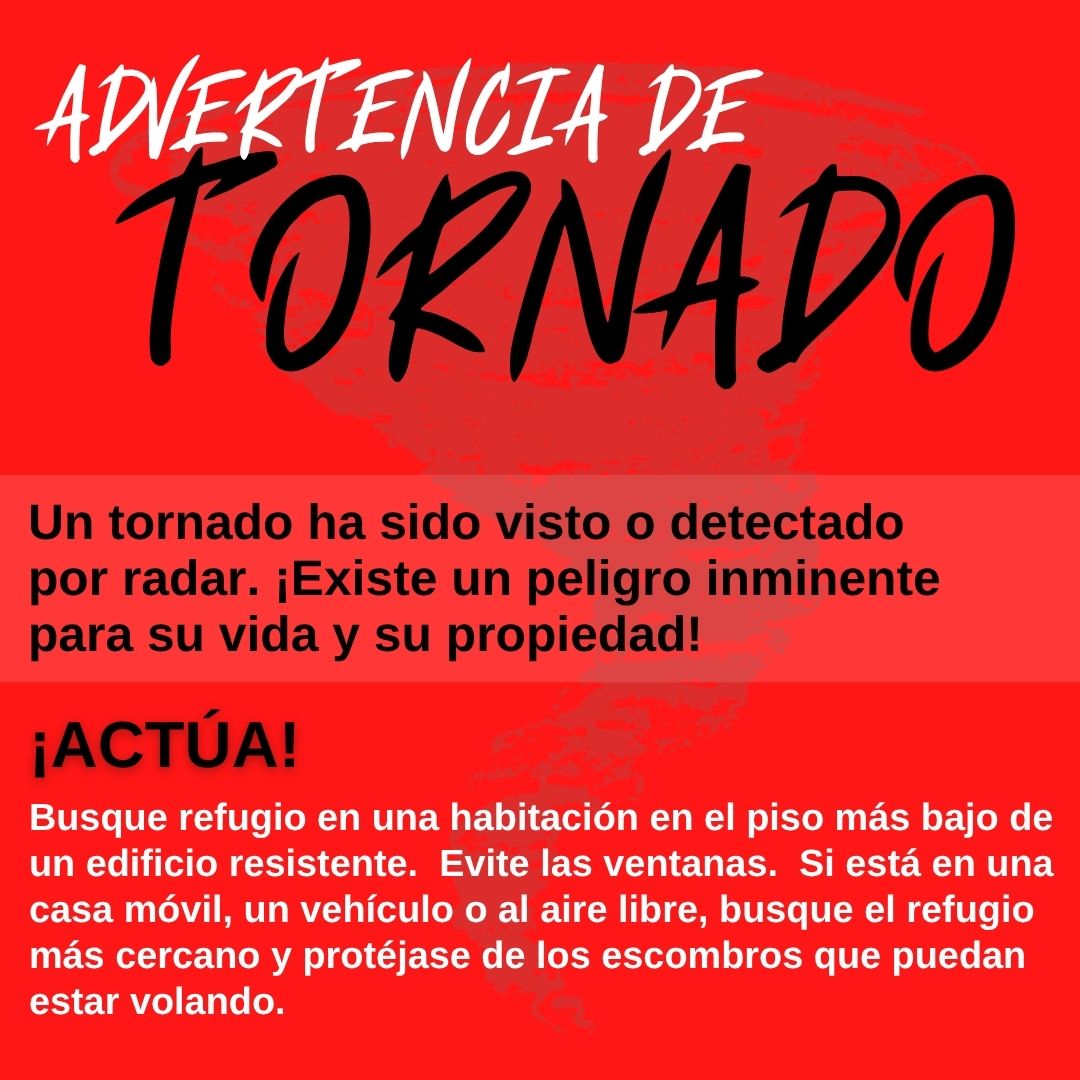
Vigilancia de tornado vs. Advertencia de tornado: ¡Conozca la diferencia!
Vigilancia de tornado (Tornado Watch): Existe la posibilidad de que se formen tornados. Manténgase alerta y prepárese para buscar refugio.
Advertencia de tornado (Tornado Warning): Se ha detectado un tornado o se espera que ocurra pronto. ¡Busque refugio seguro inmediatamente!
Recuerde mantenerse informado a través de las actualizaciones meteorológicas oficiales. Para recibir alertas, envíe un mensaje de texto con la palabra CEMA al 77295 o siga a CEMA en sus redes sociales: Facebook (Chatham Emergency Management Agency), Instagram (Chatham EMA), y X (Chatham EMA).
This translation is made possible through a partnership with GROW Initiative GA/Esta traducción es posible gracias a una colaboración con GROW Initiative GA, una organización sin fines de lucro.
Hurricane Isaias Update #2
Date: Friday, October 9, 2026 at 3:00 p.m.
Stay informed with official CEMA updates.
- Text Alerts: Text CEMA to 77295.
- Facebook: Chatham Emergency Management Agency
- Instagram: Chatham EMA
- X: Chatham EMA
Continue to follow official weather updates and guidance from local emergency management officials throughout the weekend.
Additional Links:
Hurricane Isaias Update #1
Date: Friday, October 9, 2026 at 11:07 a.m.
Heavy Rain Expected This Weekend
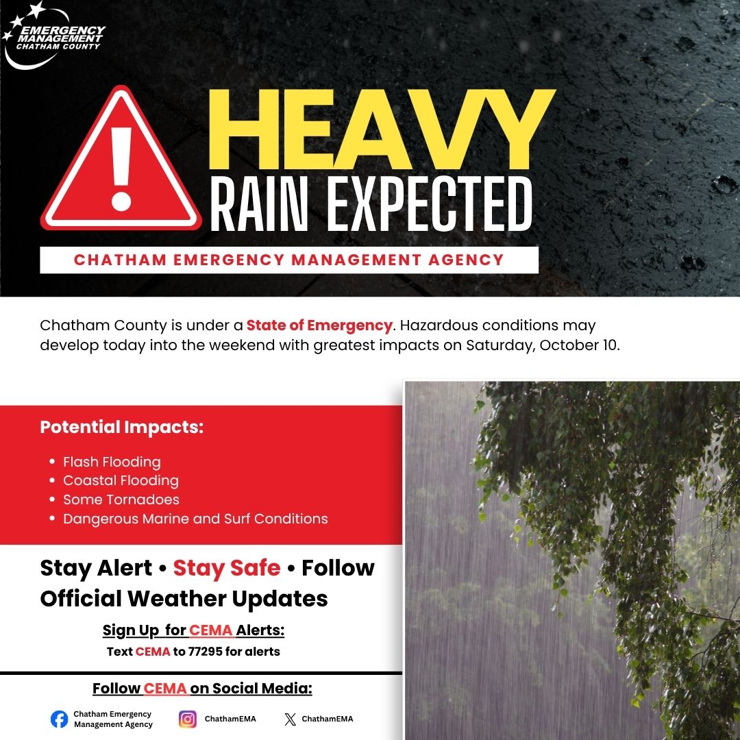
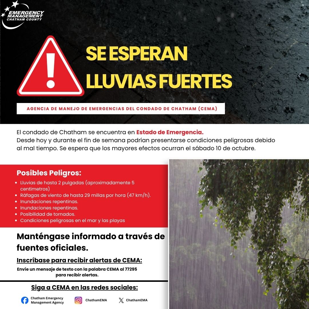
Chatham County is under a State of Emergency as hazardous weather conditions are expected to develop today and continue into the weekend, with the greatest impacts anticipated on Saturday, October 10.
Potential impacts include rainfall amounts of up to 2 inches, wind gusts up to 29 mph, flash flooding, coastal flooding, possible tornadoes, and dangerous marine and surf conditions.
Residents are encouraged to monitor weather conditions, remain alert, and take precautions to protect themselves and their families.
Stay informed with official CEMA updates.
- Text Alerts: Text CEMA to 77295.
- Facebook: Chatham Emergency Management Agency
- Instagram: Chatham EMA
- X: Chatham EMA
Continue to follow official weather updates and guidance from local emergency management officials throughout the weekend.
Additional Links:
Georgia Emergency Management and Homeland Security Agency